-
- TOPEX/Poseidon
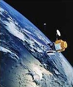
Launched in 1992, TOPEX/Poseidon was a joint satellite mission between NASA, the U.S. space agency, and CNES, the French space agency, to map ocean surface topography. The first major oceanographic research vessel to sail into space, TOPEX/Poseidon helped revolutionize oceanography by proving the value of satellite ocean observations. The distinguished oceanographer Walter Munk described TOPEX/Poseidon as “the most successful ocean experiment of all times.” A malfunction ended normal satellite operations January 2006.
-
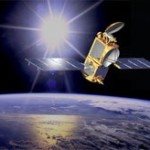
- Jason-1
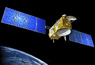
Jason-1 was the first follow-on to the highly successful TOPEX/Poseidon mission. This second joint NASA-CNES mission was built on a French spacecraft, and launched on an American Delta II rocket from Vandenburg Air Force Base in California. Like TOPEX/Poseidon, the payload included both American and French instruments. Jason-1 altimeter data is part of a suite of data provided by other JPL-managed ocean missions.
-
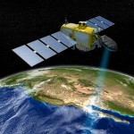
- Calypso
CALIPSO is a joint NASA (USA) and CNES (France) environmental satellite, built in the Cannes Mandelieu Space Center, which was launched atop a Delta II rocket on April 28, 2006. Its name stands for Cloud-Aerosol Lidar and Infrared Pathfinder Satellite Observations. Passive and active remote sensing Instruments on board the CALIPSO satellite will monitor aerosols and clouds 24 hours a day. CALIPSO will fly in formation in the “A Train” with several other satellites (Aqua, Aura, CloudSat and the French PARASOL).
-
- WISE
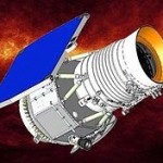
Wide-field Infrared Survey Explorer (WISE) is a NASA infrared-wavelength astronomical space telescope launched on December 14, 2009, and decommissioned/hibernated on February 17, 2011 when its transmitter was turned off. The US$320 million mission launched an Earth-orbiting satellite with a 40 cm (16 in) diameter infrared telescope, which performed an all-sky astronomical survey with images in 3, 5, 12 and 22 μm wavelength range bands, over 10 months. The initial mission length was limited by its hydrogen coolant, but a secondary post-crygenic mission continued for four more months.
-
- NEOWISE
NEOWISE: Funded by NASA’s Planetary Science Division, NEOWISE harvests measurements of asteroids and comets from images collected by the Wide-field Infrared Survey Explorer (WISE) spacecraft. NEOWISE provides a rich archive for searching for solar system objects.
WISE was launched into a low-Earth orbit in December 2009, and surveyed the full sky in four infrared wavelength bands (3.4, 4.6, 12 and 22 µm) with a 40 cm (16 in) diameter infrared telescope until the frozen hydrogen cooling the telescope was depleted in September 2010. Throughout this time, NEOWISE searched the WISE data for moving objects. Starting in October 2010, the mission was renamed NEOWISE, and the survey continued for an additional four months using the two shortest wavelength detectors. The spacecraft was placed into hibernation in February 2011, after completing its search of the inner solar system.
-
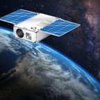
- Asteria
ASTERIA (Arcsecond Space Telescope Enabling Research in Astrophysics) is a technology demonstration and opportunistic science mission to advance the state of the art in CubeSat capabilities for astrophysical measurements. The goal of ASTERIA is to achieve arcsecond-level line of sight pointing error and highly stable focal plane temperature control. These technologies will enable precision photometry, i.e. the careful measurement of stellar brightness over time. This in turn provides a way to study stellar activity, transiting exoplanets, and other astrophysical phenomena, both during the ASTERIA mission and in future CubeSat constellations.
NOAA
-
- OSTM/Jason-2
The Ocean Surface Topography Mission (OSTM) on the Jason-2 satellite is an international Earth observation satellite mission that continues the sea surface height measurements begun in 1992 by the joint NASA/CNES TOPEX/Poseidon mission and followed by the NASA/CNES Jason-1 mission launched in 2001.
Like its two predecessors, OSTM/Jason-2 uses high-precision ocean altimetry to measure the distance between the satellite and the ocean surface to within a few centimeters. These very accurate observations of variations in sea surface height—also known as ocean topography—provide information about global sea level, the speed and direction of ocean currents, and heat stored in the ocean.
-
- Jason-3
Jason-3, a U.S.-European satellite mission, lifted off from Vandenberg Air Force Base in California January 17, 2016, at 10:42 a.m. PST aboard a SpaceX Falcon 9 rocket, to become the latest spacecraft to track the rate of global sea-level rise. Jason-3 will also help NOAA’s National Weather Service more accurately forecast the strength of tropical cyclones that threaten America’s coasts.
While flying in a low orbit, 830 miles above the Earth, Jason-3 will use a radar altimeter instrument to monitor 95 percent of the world’s ice-free oceans every 10 days. Since the Topex/Poseidon, and Jason satellite missions started in 1992, researchers have observed global sea-level rise occurring at a rate of 3 mm a year, resulting in a total change of 70 mm – or 2.8 inches – in 23 years.
